Ground-Truthing RCA Models Through Comparison of Video and Fishing Surveys
Currently, the west coast groundfish fishery is highly constrained by the Rockfish Conservation Area (RCA), a depth-base closure established in 2002 to help reduce the bycatch of overfished species. However, the RCA also constrains fishing opportunities for abundant target stocks.
In an effort to assess the effects that the RCA has had on local rockfish populations, the Fisheries & Conservation Biology Lab at MLML worked with commercial fishermen and scientists from the Nature Conservancy, National Marine Fisheries Service, California Department of Fish and Wildlife, and the Environmental Defense Fund to ground-truth predictive maps that model the distributions, abundances, and sizes of overfished groundfish stocks along the west coast.
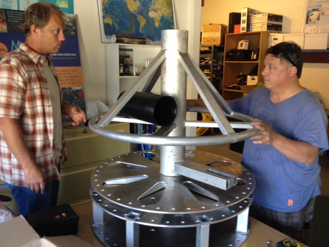
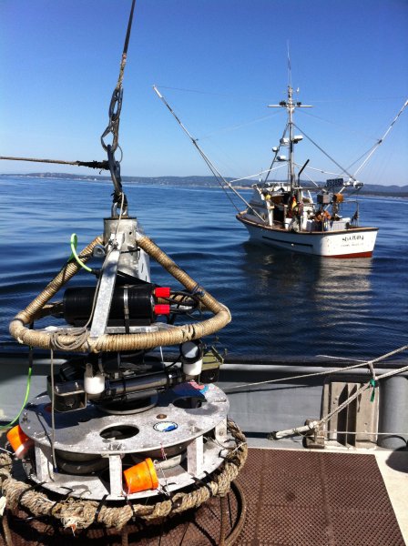
We worked with engineers at Marine Applied Research and Exploration (MARE) to design and build a rotating, stereo-video lander.
The overarching objectives of this study were to conduct visual surveys and use directed fishing techniques to assess encounter rates with overfished species (OFS) from a subset of locations within the RCA.
To accomplish this, we:
- Used the combination of existing fisheries independent and dependent data and local knowledge to develop predictive maps of the distribution, abundance, and size of overfished groundfish stocks along the entire West Coast.
- Ground-truthed the predictive maps by performing scientifically-rigorous sampling (visual surveys and directed fishing) to assess encounter rates with OFS in a subset of locations inside the trawl and non-trawl RCAs in central California with predicted high, medium, and low density of OFS.
- Characterized the abundance, length, and habitat associations of OFS in those same locations, as well as collect biological samples of OFS for growth and maturity studies.
This work gathered data on the distributions and abundances of both rebuilding and healthy fish populations and provided e greater flexibility for management with more fine-scale spatial information.
Check out the lander photo gallery
Video lander data presented at the CalCOFI Conference in 2014.
Video lander data presented at the Western Groundfish Conference in 2014.