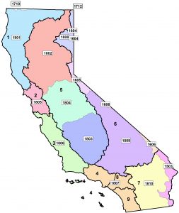
 Use the image of California to help determine the appropriate NHD 24k data layer (derived from http://nhd.usgs.gov/) to download based on the approximate station location. After downloading the correct NHD 24k data layers zip file, extract the folder within it to a location on your computer. Then access this folder through ArcGIS to add the appropriate geodatabase or through ArcGIS or another GIS program to add the appropriate shapefile layer to your Project file. To obtain the Reach information, open Hydrography and then NHDFlowline to add the blue line layer. To obtain the HUC 12 information, open WBD and then WBD_HU12 to add the polygon layer.
