
By Ryan Fields, MLML Fisheries and Conservation Biology Lab 
Ryan Fields serves as lab technician to the Fisheries and Conservation Biology Lab (FCB lab), where he also studied for his Master's degree. As a technician Ryan continues to participate in lab projects that include California Collaborative Fisheries Research Program and the development of new video lander tools to improve fisheries management of Pacific rocky reefs.
This October, the Fisheries and Conservation Biology Lab completed a month-long research cruise along the California coast testing a new video camera tool designed to survey fishes. This was both a fantastic project and trip, and I want to share a few highlights from video we collected. The main goal of this project was to design, build, and demonstrate the feasibility of deploying a video lander tool at a scale that is useful for fisheries management agencies (i.e. a coastwide survey). We were very successful in meeting this first goal, and in 24 days we conducted 419 visual surveys across 295 miles of coastline between Half Moon Bay and Anacapa Island.
You can see the tool in the photo above and watch this video of us deploying the BOSS last year in Southern California.
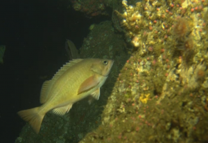
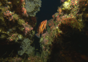
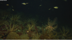
Rocky reef habitats in deep water are home to some of the most important species of fishes to commercial and recreational fisheries, such as lingcod and rockfish. Perhaps not surprisingly, their depths make them notoriously difficult to sample. There is a need to develop better survey techniques for this challenging but ecologically-critical habitat. Drop cameras, or “video landers,” have been gaining traction as a relatively affordable and non-destructive alternative to other fisheries survey techniques such as ROVs (great data, but expensive) or trawl-gear (potentially destructive, limited to soft bottom habitat).
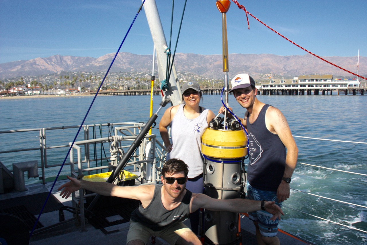
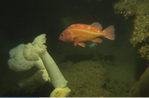
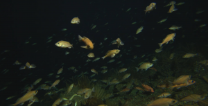
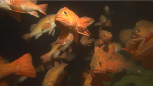
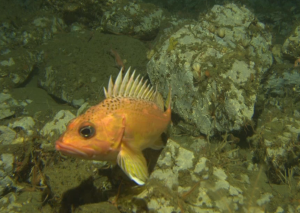
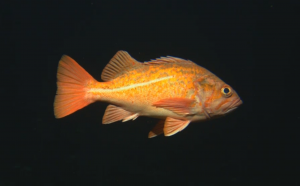
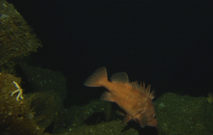
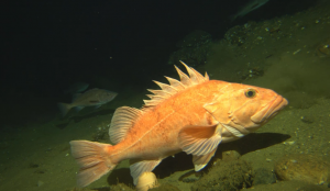
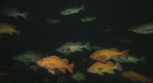
Our video lander, dubbed the Benthic Observation Survey System (BOSS), is a continuation of multiple years of video lander research that Rick Starr began in 2012. Along with The Nature Conservancy, we partnered with engineers from the Monterey Bay Aquarium Research Institute (MBARI) to design and build a video tool that could rapidly be deployed from a ship and that could cover large geographic survey areas. One cool technical upgrade from our past videos systems was the use of a fiber-optic cable, which allowed for 9 streams of high-definition footage to be simultaneously viewed and recorded. As someone who has completed hours of video analysis and fish identification, high-quality video is a game changer for getting accurate and reliable data. Just check out how crisp these video screenshots are!
Another goal of this project was to deploy in areas without good bathymetric mapping --mapping of the bottom similar to a topographic map on land -- to see how well we could locate rocky reef in deep water. This was sometimes frustrating, but we generally succeeded in finding rock to survey. Sometimes we found too much rock – check out this video of us narrowly avoiding a cliff outside of Carmel Bay!
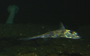
One highlight of our trip came from exploring a steep boulder incline behind Santa Rosa Island. The feature itself was captivating because it was so steep and covered in giant square slabs of rock. At a depth of 200m, we were surprised when not one, but two sixgill sharks gracefully loomed out of the dark to investigate this strange glowing cylinder. We stayed in the area for a while longer to capture this video clip.
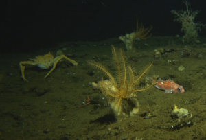
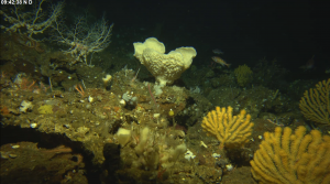
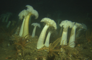
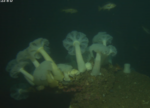
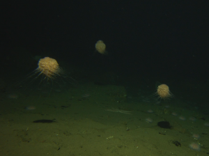
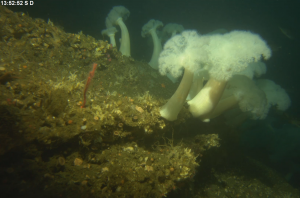
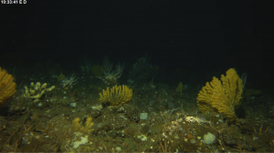
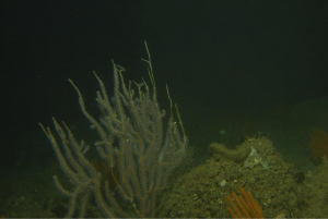
Even though I’m not an ‘invert-guy’ by trade, I could not help but be excited at all the mesmerizing corals, anemones, feather stars, and sponges we saw on this trip. Some of my favorites were at a site called Footprint SMR near Anacapa Island where beautiful yellow corals were growing at 180m depth. Here is a small sample of the sometimes strange but always captivating invertebrates that covered the seafloor.
My favorite memory from this research cruise was undoubtedly the moment five humpback whales decided to crash the fish party and hang around our research vessel for an hour. They seemed curious and possibly accustomed to the whale watching boats in the vicinity. When we saw the whales approaching, we stopped our engines and brought the BOSS near the surface to avoid any entanglement – then got out our cameras! We didn’t mind that work was stalled for an hour as these whales put on quite a show. Though I’ve seen a lot of whales before, this was one of the best whale-watching experiences in my life. Clear water allowed us to see the white pectoral fins of the humpback whales as they flipped on their backs and passed under the boat. I never realized how flexible and graceful these whales could be — 20-ton, underwater ballerinas.
Check out these video clips we were able to capture.
There were plenty of other great memories from this trip as well including the experience of seeing the western Channel Islands up close. Now that the fieldwork is over, another work begins: analyzing many hours of video footage recorded. While sometimes tedious, I’m really looking forward to reliving all these trip highlights and discovering new ones hidden in the video during the months of processing ahead.
To learn more about the building of the BOSS itself, you can check out MBARI's posts about the initial building and subsequent upgrades they made to the rover.
For more neat footage, see the following YouTube links: