Adventures in Mexico 2018: A healthy southern kelp forest

By Ann Bishop, Phycology Lab

AB_1
Ann Bishop examining seaweed (Photo: Laurel Lam)

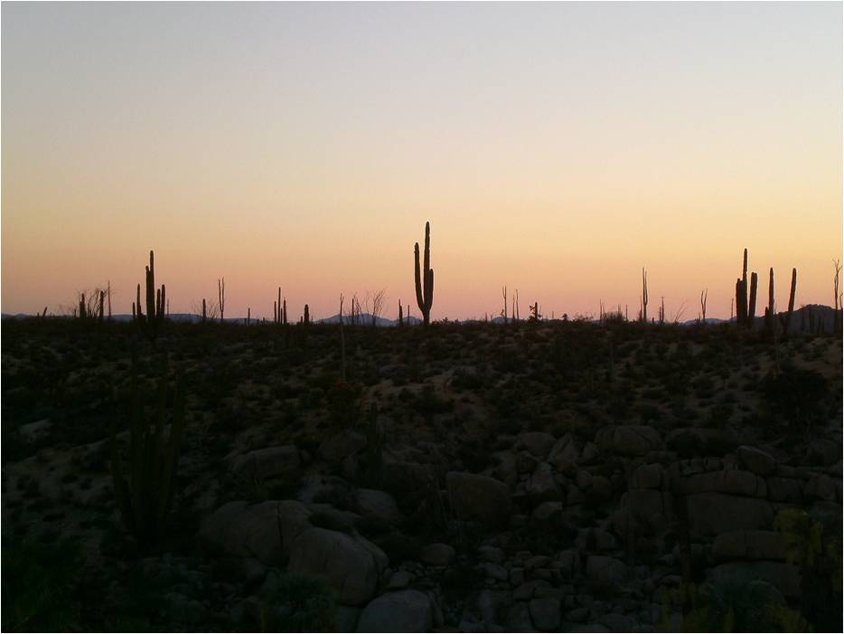
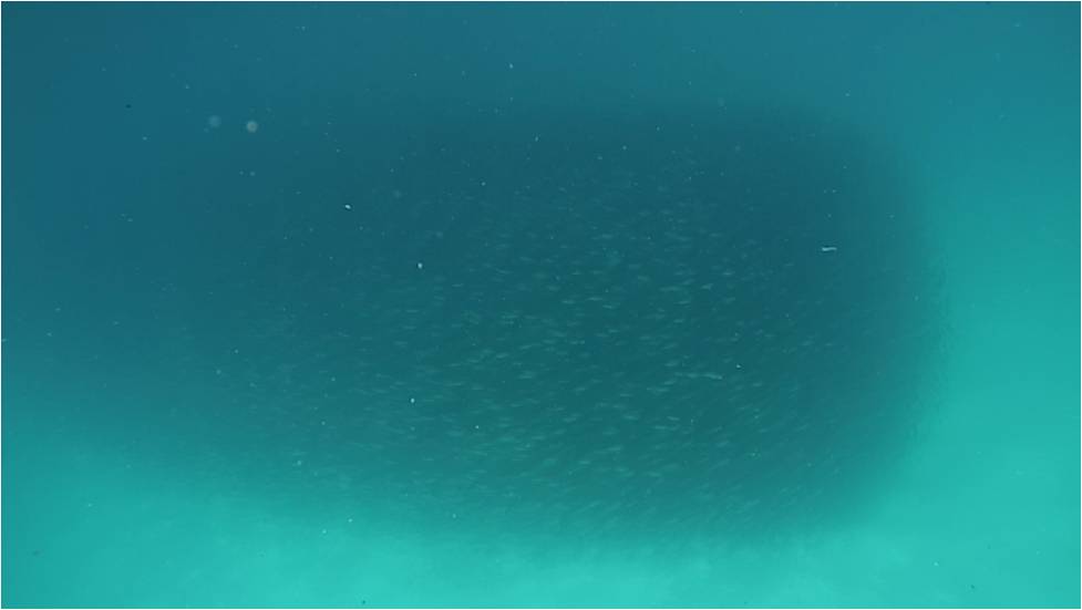
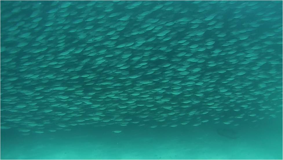
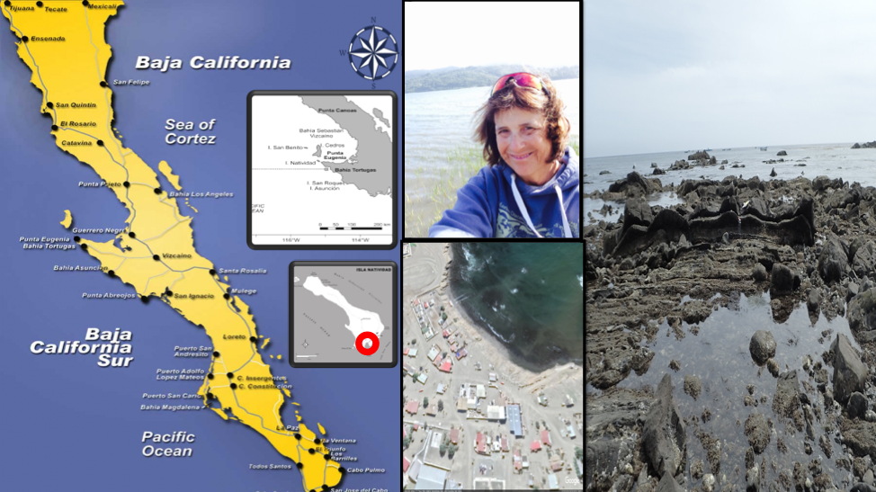
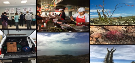
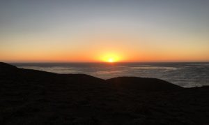
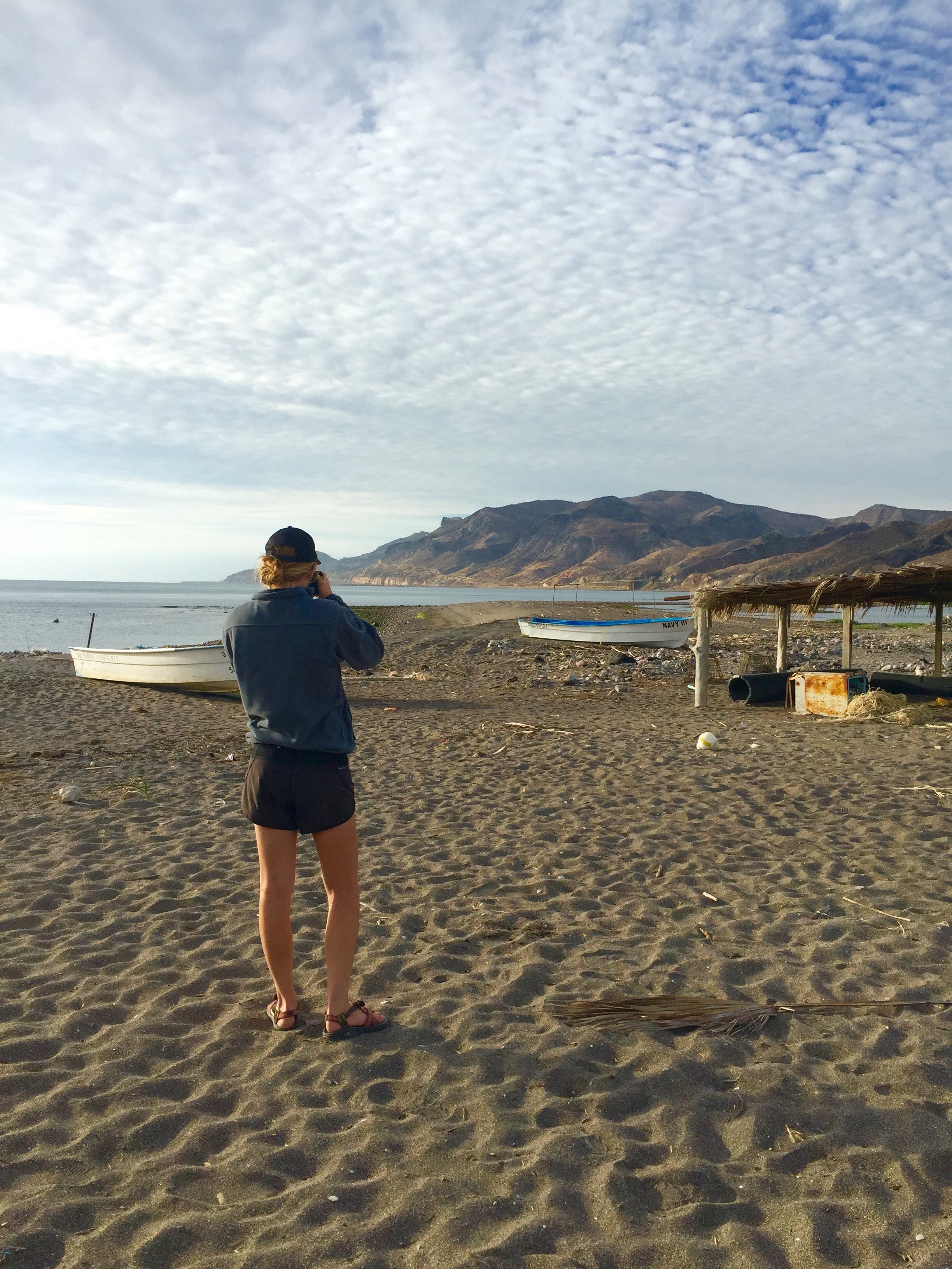
This year the Baja field class traveled to Isla Natividad to experience a giant kelp forest at the southern end of Macrocystis pyrifera’s range. Looking from the surface, the waves of turquoise water and the tendrils of sienna scimitar blades mirror those of Monterey Bay and of Southern California. It’s only once you dive beneath the surface you can begin to understand that we are not in Monterey anymore.

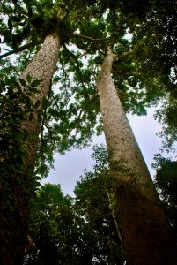
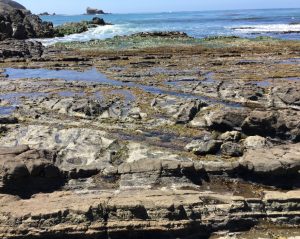
The Monterey Bay kelp forest has its own structure of over story, understory, and benthic covering seaweeds. But, these layers and the species that develop them are not always so clear cut- based on a patchwork of substrate and exposure to the storms. Much like an eastern forest can be a mix of deciduous, conifers, shrubs, and meadows.

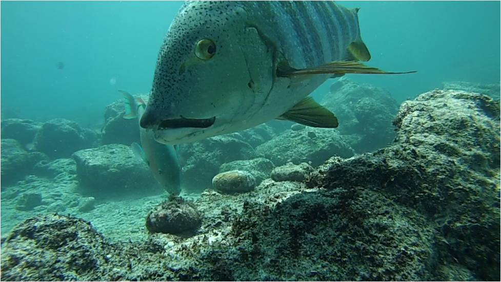
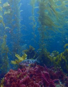
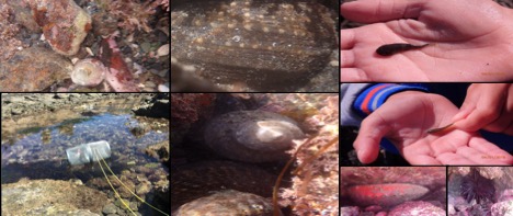
The kelp forest on Isla Natividad, is less this patchwork and more like standing at the bottom of an old growth rainforest. The kelp grows in thick stands, sometimes so dense that becoming tangled and un-tangled is a habit rather than an event. The understory Ecklonia grows in incredible abundance. Their waving blades create the impression that the bottom is right there, maybe not even a hands breadth away. But, instead it hides yet another layer. Underneath the Ecklonia, are a fascinating array of wine-red algae, feathery pink corallines, gorgonian fans, anemones, sponges, and most unlikely of all- rotoliths! These slow growing crustose coralline algae are often mistaken for rocks rolling across a sandy plane, but here they were, thriving under their towering brown cousins.

Like their terrestrial counter parts, these forests reflect the impacts of the human communities who rely on them. Isla Natividad looks the way it does today because of the careful management practices and intense love the people have for their island. The willingness of the co-operative to learn, flexibility to adapt, coupled, with their ability to exclude poachers has resulted in the rich underwater world we were permitted to visit.

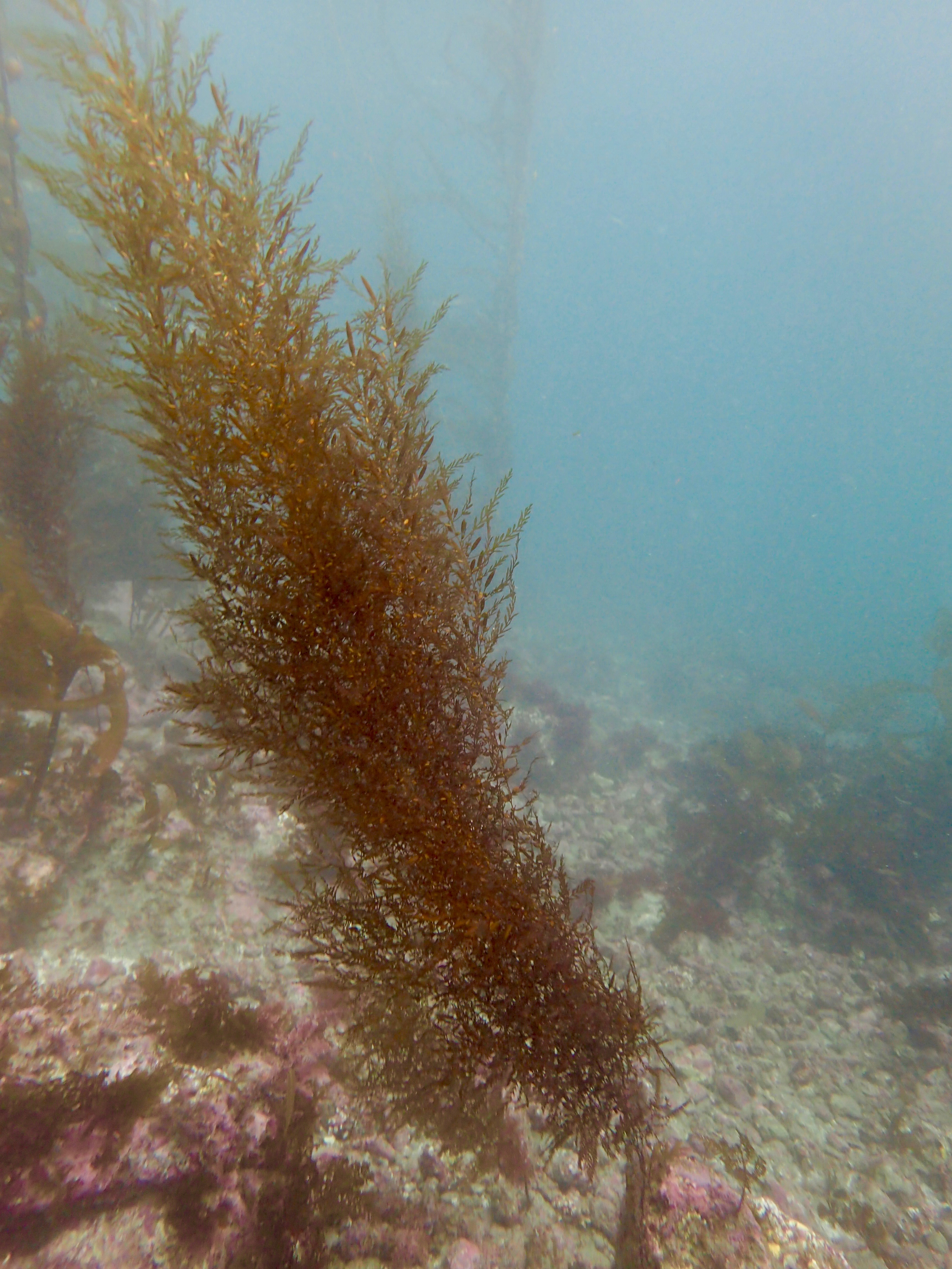
Yet, even the best laid plans and managers can face new challenges in the changing oceans. Other kelp forests, faced with warming seas have been heavily impacted by an increase in invasive species. Invasive seaweeds Sargassum horneri and an aquarium variety of Bryopsis to name some of recent new arrivals. The impact of invasive that may be familiar to Californians might be the difference that can be seen in the growth of S. horneri on Santa Catalina, off the coast of Los Angles, before and after the 2015 El Nino.

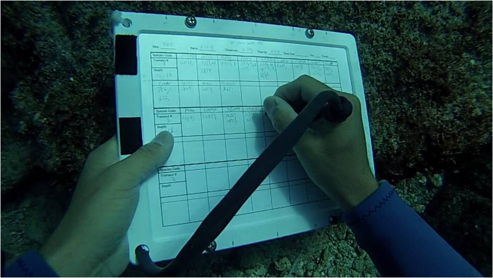
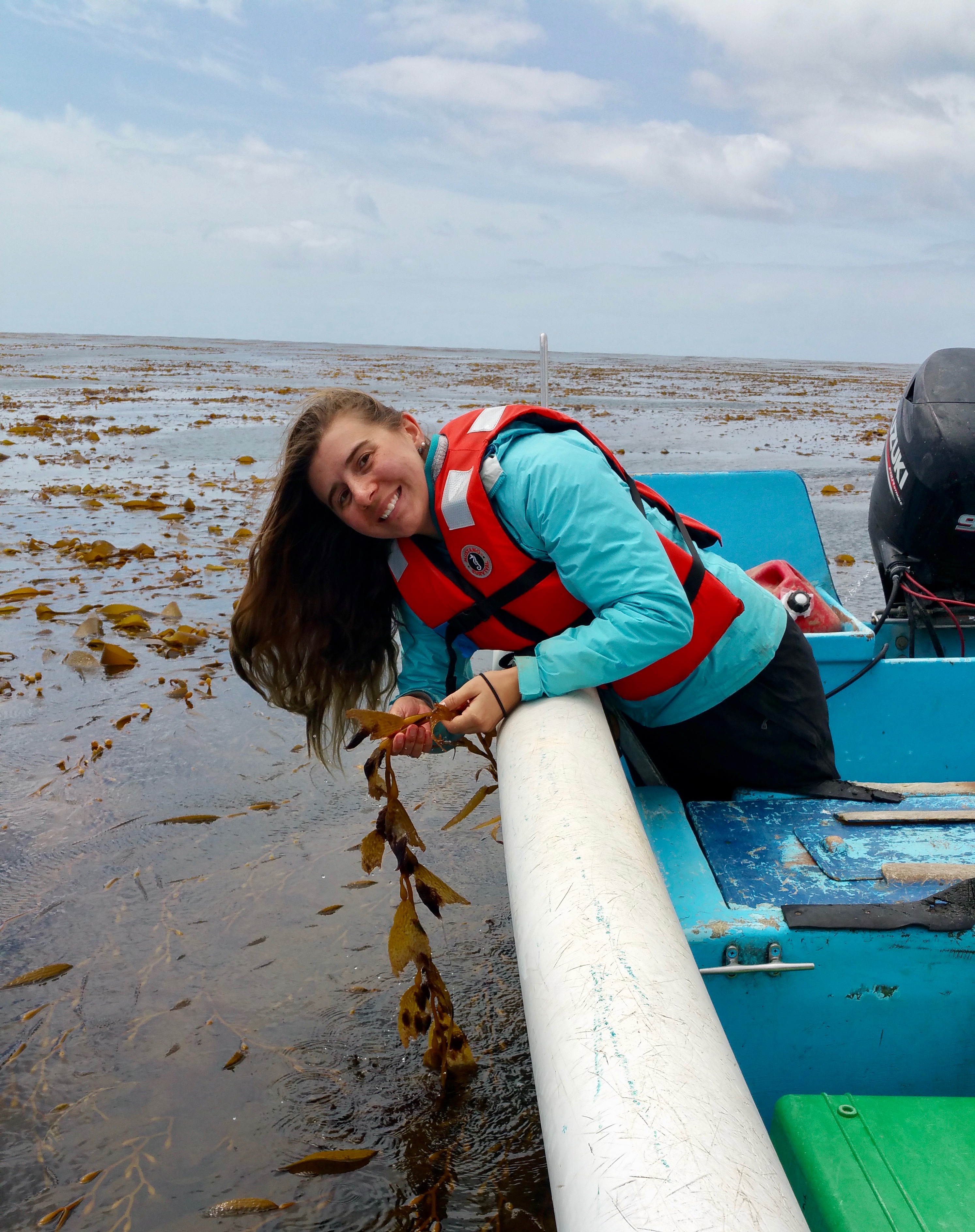
On Isla Natividad, both these invasive seaweeds are present but, fortunately have not been able to dominate the island. At least not yet. My project focused on identifying and quantifying where S. horneri was present around the island. While only a few of the sites we explored contained S. horneri, I am hoping the data from my project can assist with monitoring and future management. Knowing the baseline of an invasive species gives the managers important information and tools should those species begin to take the place of the native and endemic species. With knowledge, management, and a little bit of luck the community of Isla Natividad will be able to fish, share, and protect their underwater forests for generations to come.

OLYMPUS DIGITAL CAMERA
Invasive seaweed Sargassum horneri (Photo by Diana Steller)

Adventures in Mexico 2018: Best-made plans versus the reality of adjusting to field conditions

By Hali Rederer, student of California State University Sacramento

HRBlog_Picture1
Left to right: Map with my rocky intertidal research site inside an Marine Protected Area (MPA) circled in red, picture of me, overview of my site, and a tide pool within the MPA.

This course broadened my field skills, and enabled me to research rocky intertidal ecology; specifically, tide pool fish. This is a new field of marine fish ecology for me. Designing and carrying out a tide pool fish study, in a very short time frame, in a place I had never been, presented challenges requiring flexibility and creative approaches.  Implementing a tide pool fish scientific study was one aspect of my experience. Importantly, and most enriching, was the opportunity to spend time with two university students from Ensenada and getting to know residents of Isla Natividad, and enjoying the food and culture of Baja.  We were embraced by the local community and welcomed.  A youngster named Lalo helped me collect tide pool data daily and we participated in local holiday celebrations. Facilities were made available to us including a comfortable house, cabins, and a laboratory to work out of.

My fellow students and I were immersed in rich practical “hands on” experiences integrating scientific field methods with experimental design.  This course was comprehensive and the pace was fast. Designing and carrying out a tide pool fish study, in a very short time frame, in a place I had never been, presented challenges requiring flexibility and creative approaches. We spent close to eight hours in the field everyday followed by laboratory work and discussions of our projects in the evenings. Topics for specific experiments, laboratory sessions, and discussions derived from our individual research questions, interests, and ideas emerging from our explorations and observations while in the field.

HRBlog_picture2
Road trip from MLML to Mexico

My scientific question: What are the differences between intertidal fish found in higher versus lower tide pool and related tide pool geomorphology?

My research site was a rock strip 400m x 60m. My study accomplished a survey of 30 tide pools for differences in fish abundance, diversity, and distribution patterns in higher versus lower tide pools throughout one MPA rocky intertidal site.  I observed and recorded invertebrates, sea grasses, and algae using quadrats. Location, physical features (substrate roughness, water clarity) and physical dimensions of each tide pool were measured. Vertical and horizontal distance from shore was measured to establish the relative position of each tide pool I needed to be constantly aware of tidal influences as the major oceanographic process regulating this tide pool habitat. Integration of physical and biological data stands to capture a more comprehensive picture of Isla Natividad tide pool fish.

The tide pool fish study I had proposed [before departure] needed to change; I had originally planned to capture and measure the weight and length of each fish found in tide pools within one entire site. Turns out that it took too long to capture fish and therefore I adjusted and changed the methods of my study to a visual survey however the overall goal I had of studying tide pool fish remained unchanged.

Position, location, and quality of water in a tide pool is important to intertidal fish, invertebrates, algae, and sea grasses. Near shore coastal marine habitats are vulnerable to anthropomorphic disturbances and influences. Trash is apparent in the MPA site I studied including being found in the tide pools themselves. I roughly measured the debris field and describe its waste stream contents as a second rapid study since residents expressed interest in cleaning up the MPA.

Intertidal species.
Wavy turban snail, baited fish trap, Wavy Turbin Snail, Abalone, Opal eye, Woolly Sculpin

Science as a Collaborative Social Activity 

This experience reminded me of how rewarding teamwork in science can be. I was ill to various degrees during the entire trip and was unable to work on my project at all for the first three days on Isla Natividad. Lots of people pitched in to help me complete a tide pool fish study. Field biology works well when there is collaboration and sharing of ideas. I found it comforting when I observed some fish or invertebrate that I thought was different and fellow students or the professors concurred or disagreed and further discussed what might be the most probable explanation. Cheers to my fellow students and a heartfelt thanks to the Professors and teaching assistants. I am eager to apply what I learned on Isla Natividad by sampling tide pool fish in other places along the California current.

Adventures in Mexico 2018: Island Life on Isla Natividad

By Jackie Mohay, Fisheries and Conservation Biology Lab

Imagine; you live in a small community on a remote island in the Pacific Ocean where a hardworking life is simple and fulfilling. One day you are told that a group of 20 will be travelling to your island to study it, using your resources and living amongst you for over a week. The people of Isla Natividad welcomed us with more than just open arms. During our first meeting, they remained patient while some of us tried to speak our best broken Spanish, were genuinely curious about our projects and most of all, elated to help. Mayte, the island’s tourism director, was constantly making herself available to provide us transportation on the island and show us around. Captains Rafael and Jesus drove the SCUBA teams to their sites everyday accompanied by divemasters Ivan and Johnny.  Needless to say, they wanted to be involved as much as possible, and it was much appreciated!

Studying on Isla Natividad was something that I didn’t want to end. Not only because of their way of life and friendly locals, but because there is so much more to explore. My intertidal project comparing invertebrate and algal cover inside and outside one of the MPA’s was barely the tip of the iceberg. After a week of exploring the intertidal, I was left with more questions than when I arrived. A workday consisted of sampling transects at low tide, then exploring tide pools to look for juvenile opaleye and sea hares while simultaneously birdwatching the osprey nested on “castle rock” as  referred to by locals(basically multitasking at its finest).

I am truly appreciative for this experience and have learned so much in such a short amount of time. I hope my trip to Isla Natividad was not a once in a lifetime experience, but if so, I am grateful I was able to explore and contribute to the scientific understanding of this unique island.

Tacos, Takis, and Fish Diet: A Spring Break Saga

By Holly Chiswell, MLML Chemical Oceanography Lab

Andddd we're back!

Over our spring break and the week after, 20 Moss Landing-ers drove down to Baja California Sur to conduct fieldwork on the island of El Pardito, off of La Paz…for class! The drive down took three days and we were equipped with: two trucks, a van, two large trailers, two boats, two kayaks, a metric crap ton of dive dear, camping gear, personal gear and food. The first night we glamped, aka stayed in a hotel in San Diego after a day of driving which included going through “fun” Los Angeles traffic trying to get truck drivers to honk their horns. Apparently this is what entertains a car full of students in their mid to late 20s. The next morning, we crossed the border into Mexico, filled out the visa paperwork and trucked on.

We continued down highway 1 through Baja California on the Pacific side to our camping destination of the evening, Cataviña, where an adorable Labrador greeted us in the desert. The next day of driving landed us in Bahia Concepción, which just so happened to have a carnival on the beach! So after we swam, kayaked and explored the bay, we went to the carnival to indulge in a mechanical bull, bumper cars (it may have gotten personal), and a ride that hung us upside down for far too long for comfort. We continued the next day across the peninsula to hit the Gulf side where we were going to camp in Portugues, a small town where the family from the island has friends and our pick up location to get to the island, but that afternoon we ran into trouble. The dirt road we were supposed to take is usually completely dry, but when we got there it was a little wet and the tide was coming in. Therefore, one of the trucks complete with a trailer attached and the dive compressor inside got stuck at about 4 o'clock in the afternoon. Seeing this treachery, the other two vehicles were able to back out but we spent hours attempting to get the truck out, digging and placing rocks while also utilizing local help. We ended up unloading the truck and detaching the trailer before a SEMI truck was able to pull us out at around 11 that evening. The brothers that helped us were so kind and let us camp in what was essentially their backyard before getting to the rally point in the morning.

Alexa snaps a quick photo at our campsite.

The next morning we loaded everything onto 5 pangas (boats) and traveled about 30 minutes to the island of El Pardito. This was our beautiful home for the following nine days of science. We would wake up around dawn (some of us went out with the fishermen to pull in nets they had set the night before), and then went about fieldwork for the day: diving, fishing, surveying, or spending time in the mangroves for respective projects. At night we would convene, (pretty late because some of us went hand-lining at night and then had to do some post fishing processing), to eat dinner (usually fish of sorts) and go around the circle saying what we did that day, what our plans were for the next day and if help was needed in the form of dive buddies or boat companions. As everyone took their turn speaking, I was very impressed with how on top of his or her research everyone was. They knew what they were doing, had protocols set and made the most of the limited time we had. After dinner, I would stay up pretty late each night processing fish stomachs from the fishermen for my project, a diet study, and now have 88 preserved samples to look through!

The families on the island were the sweetest people you'll ever meet. They were patient with our range of Spanish speaking abilities within the group, wanted to help us on our projects however they could, and were interested to learn about what we did. One woman on the island even let us come into her house and taught us how to make tortillas! Towards the end of the trip we had a bonfire and played music and chatted for quite some time, really bonding everyone on the island.

A view from the island.

We decided as a group to stay a night in La Paz before driving back up which was amaaaaazing. Mostly because we finally got a chance to shower, but also because we went out to dinner as a group and hit the town after working so hard for those eight days straight! On our way back we had a flat tire one of the days, but we worked really well as a group and got it changed within the hour. After the rest of the journey continued without a hitch, we made it back to Moss Landing and have been playing sleep catch up and life catch up since then.

pardito2Overall, it was an amazing experience. I learned a great deal by choosing a project not in my area of expertise and expanded my worldview... all while getting a tan! Who’s up to take the trip again?

Tales From the Field, Back to Baja: Three weeks in the Gulf of California.

By Scott Miller

Although MLML has some great resources on campus, students also occasionally have opportunities to get out of central California and do some work in other areas. Some of you may remember my post about my time in the Gulf of California last year with MLML’s “Baja class” where I studied herbivorous fishes. Well, I was given the opportunity to go back to Baja earlier this year to build upon the study that I began previously. In mid-June, I was part of a research team with two other MLML students and our dive safety officer / research faculty, Dr. Diana Steller, to help out on some projects through UC – Santa Cruz and to work on the herbivore project.

Because we needed to transport some large supplies, including scuba tanks and the field air compressor (to fill up the scuba tanks), we needed to drive down and back again this year. Although it sounds tough, the drive is only 3-4 days, and it’s definitely part of the adventure!

Just after sunset at our desert campsite in Cataviña, Baja California.
Driving isn’t too bad when you get to camp at sites such as this at Playa Requesón! Photo by Heather Fulton-Bennett

We made it safely to the island (and we even made great time, too!) and were ready to begin our work, which included studies of hawksbill turtles and their habitat, as well as studies of herbivorous fishes in the area. In order to study herbivorous fishes for this project, we first needed to conduct fish surveys to quantify fishes at multiple sites around our base at El Pardito. These surveys were part of a joint effort to survey the benthic habitats as well, and were therefore conducted in small groups, with one person surveying fish, one measuring algae, and another taking photographs of the rocky bottom.

Although the goal of fish surveys is to count and size fishes, they require a lot of underwater writing!

This year, in addition to fish and benthic surveys, we also placed a camera underwater to see what types of fishes we could capture on film when divers weren’t present. We’re still analyzing the data, but here’s a sneak peak of some visitors to our cameras!

An azure parrotfish, Scarus compressus, swimming by the camera. Note the rockin’ algal mustache.
It wasn’t just herbivores that swam by, as demonstrated by this barred pargo (snapper), Hoplopagrus guentherii. (But notice the bluechin parrotfish, Scarus ghobban, in the background?)

Although we travel to these remote places to do work, and we tend to work hard in order to cram as much science into our limited time, some events are too special to pass up taking a few minutes off to experience. On this trip, that happened to be a large school of small fishes that passed by a few hundred feet offshore from the island. As this was within swimming distance, I took the opportunity to snorkel out and see it firsthand.

Although it looks almost like a cloud or shadow from far away…
…when you get closer, you can see that it’s actually made of thousands of small fish!

Supposedly, yellowtail jacks and even a marlin were spotted darting in and out of this giant ball of fish, but I was the only visitor at the time when I was out there. After this short break, it was back to work until we were greeted by another beautiful sunset over the Baja peninsula. Before long, it was time to head back home to California, but not after we had collected plenty of great data and made numerous amazing memories from our short time in Baja.

Photograph by Heather Fulton-Bennett