2021 was a complex year to be a graduate student, with global societal issues demanding our attention and energy alongside our usual scientific workload. The emergence of the COVID-19 vaccines brought with it the hope of being able to safely socialize in-person with our friends and loved ones again. The resilient Moss community was able to return to some in-person activities in the Fall of 2021, including hosting the first lab Halloween party since 2019!
During this rollercoaster of a year, 14 students successfully defended their MLML theses virtually via Zoom. Please join me in congratulating the following students:
Ann Bishop, Phycology Lab
Taylor Eddy, Invertebrate Zoology Lab
Bonnie Brown, Fisheries and Conservation Biology Lab
Matthew Jew, Ichthyology Lab
Justin Cordova, Pacific Shark Research Center
Gregory Bongey, Geological Oceanography Lab
Jennifer Tackaberry, Vertebrate Ecology Lab
Sophie Bernstein, Ichthyology Lab
Rachel Brooks, Ichthyology Lab
Holly Doerr, Ichthyology Lab
Melissa Naugle, Invertebrate Ecology Lab
Kristen Saksa, Ichthyology Lab
Jacquie Chisholm, Physical Oceanography Lab
Amanda Camarato, Physical Oceanography Lab
Read below for pictures of the graduates, and explore the links to their thesis announcement posts with more info about their projects and the YouTube recordings of their defenses.
Check out posts commemorating past defenders written by MLML alumna June Shrestha: 2020, 2019, 2018, and 2017.
Hi there! My name is Bri and for my graduate thesis work at Moss Landing Marine Labs I plan to focus on microplastics in the beach habitat, and how it may be affecting the health of Monterey Bay’s ecosystem. This blog will walk you through an overview of microplastics and why this research is important. “One study estimated there are 15 to 51 trillion microplastics particles floating on the surface of the oceans. A trillion is one thousand billion. A trillion seconds is nearly 32,000 years” (National Geographic).
Microplastics pollute many aquatic ecosystems, but due to their small size, they often find themselves exempt from regulations that attempt to maintain the health of said aquatic ecosystems. Micro, coming from the Greek prefix meaning small (less than 5 mm to be precise) and plastics, also derived from the Greek word ''plastikos'' meaning fit for moulding, can come from a wide range of products with varying levels of semi- or fully synthetic polymers (materials constituted of long molecular chains (macromolecules) and organic connections obtained through processing of natural products or through synthesis of primary materials from oil, gas, or coal).
How and why we study temperature changes in the past 540 million years
You may have heard the phrase that looking to the past can help us understand the present and predict the future; but you probably didn’t think it would be necessary to go back in time over 500 million years. Global Average Temperatures are increasing rapidly due to human greenhouse gas emissions. To understand what a warmer future will be like, we can compare warming today to warming in the past.
2020 was a big year. We saw a global pandemic, protests in support of the Black Lives Matter movement, and wildfires raging across the state. Despite all of this, we had nine students pull through to defend their thesis research in 2020! Please join me in congratulating the following students:
Lindsay Cooper, Phycology Lab
Kenji Soto, Geological Oceanography Lab
Amber Reichert, Pacific Shark Research Center
Mason Cole, Vertebrate Ecology Lab
June Shrestha, Ichthyology Lab
Dan Gossard, Phycology Lab
Jacoby Baker, Ichthyology Lab
Emily Pierce, Invertebrate Zoology Lab
Miya Pavlock-McAuliffe, Physical Oceanography Lab
Please read below to learn a little more about each student's research. As always, please also check out the posts highlighting student research from previous years as well at the following links: 2019, 2018, and 2017.
Special author note: As I am one of the students that defended and graduated this year, this will be my last post for The Drop-In. From writing about classes to conferences and student research, it's been a pleasure writing for this blog. Hopefully someone else will carry the torch forward in the new year to highlight and celebrate the research of graduating students!
My time as a student at Moss Landing have been some of the most enjoyable years of my life. I have had the opportunity to learn from some wonderful professors, improve on my skills as a scientist, and do field work in places like Baja California and aboard the R/V Atlantis. While I appreciate the many academic experiences being an MLML student has given me, I am most grateful for the chance to meet you all. The MLML community is one of the most positive places I have been. Seriously, if I have talked to you before, I would really like to give you a hug and thank you for making MLML such a positive and supportive place. I have too many stories to mention here.
However, despite all of the good Moss has given me, there have been low moments too. None more so then the last few months.
To wrap up our coverage of the Habitat Mapping class projects, this week's post walks us through an investigation of the ways in which wildfires can impact both the physical condition of streams as well as the associated invertebrate community. Small invertebrates which live in the riverbed are closely linked to the sand itself. The size, shape, and composition of the sand --and therefore any changes to those conditions-- can directly affect the collection of animals found in a given stream.
Their class project explored changes in streambed characteristics resulting from one wildfire of interest: the 2016 Soberanes Wildfire. Burning throughout Monterey County, it was the most costly wildfire in U.S. history at the time, and it destroyed dozens of homes. Garrapata Creek, Soberanes Creek, Rocky Creek, and Big Sur Creek flow through the affected area, making them important streams for post-fire analysis.
We are back to covering class projects from Habitat Mapping this week. Julia Karo and Monica Appiano ("The Ladies") will walk us through their study of marshland growth in Elkhorn Slough. Recently designated a Wetland of International Importance, the Slough supports the most extensive salt marshes in California south of San Francisco Bay. Currently, a $6.5 million, 61-acre tidal wetland project is restoring drowning marshes to elevations that will better withstand changes in sea level in the coming century.
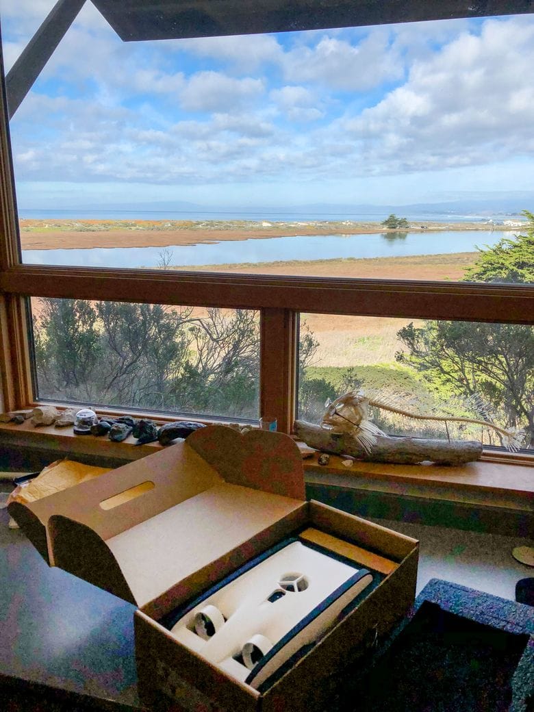
As a part of our Habitat Mapping Class this semester we undertook the mission of learning the ins and outs of seafloor mapping theory and practice to make our new Kongsberg M3 Multibeam system work. The M3 is a seafloor mapping system that has excited a lot of folks at MLML with its potential to collect geological, physical, and even biological data beneath the surface of the water. It depends upon many sensors as well as software, and right off the bat we would like to thank QPS for donating us a license to QINSY for data acquisition and Qimera for data processing! Another part of this project involved entering a National Geographic competition...which we’ll revisit later in this post.
Marcel and Miya troubleshooting the M3.
First, we must discuss the scientific questions we hope to address. We are a part of the Geological Oceanography lab and are interested in the mysterious submarine landslides that occur, starting at the head of the Monterey Canyon. A lot of research by the Monterey Bay Aquarium Research Institute (MBARI) and California State University’s Seafloor Mapping Lab (SFML) have used deep water mapping technology and other high-tech equipment to study the canyon in the deep.
From these studies, we know that massive underwater landslides occur periodically at the edges of the canyon, and have been shown to move sand, mud, and rocks miles down. We aren’t sure why they happen and they don’t seem to match up with earthquakes or storms. Our hypotheses have to do with how sediment builds up at the head of the canyon and if it is connected to the longshore sediment transport system around the Monterey Bay. Does a submarine landslide occur following a large loss of sand on the beach? Are we losing beach sand to the belly of the canyon, forever? Can we correlate submarine landslide events with any other phenomena? In order to test our hypotheses we must map the head of the canyon more frequently than ever before and the M3 is a perfect instrument to allow us to do so.
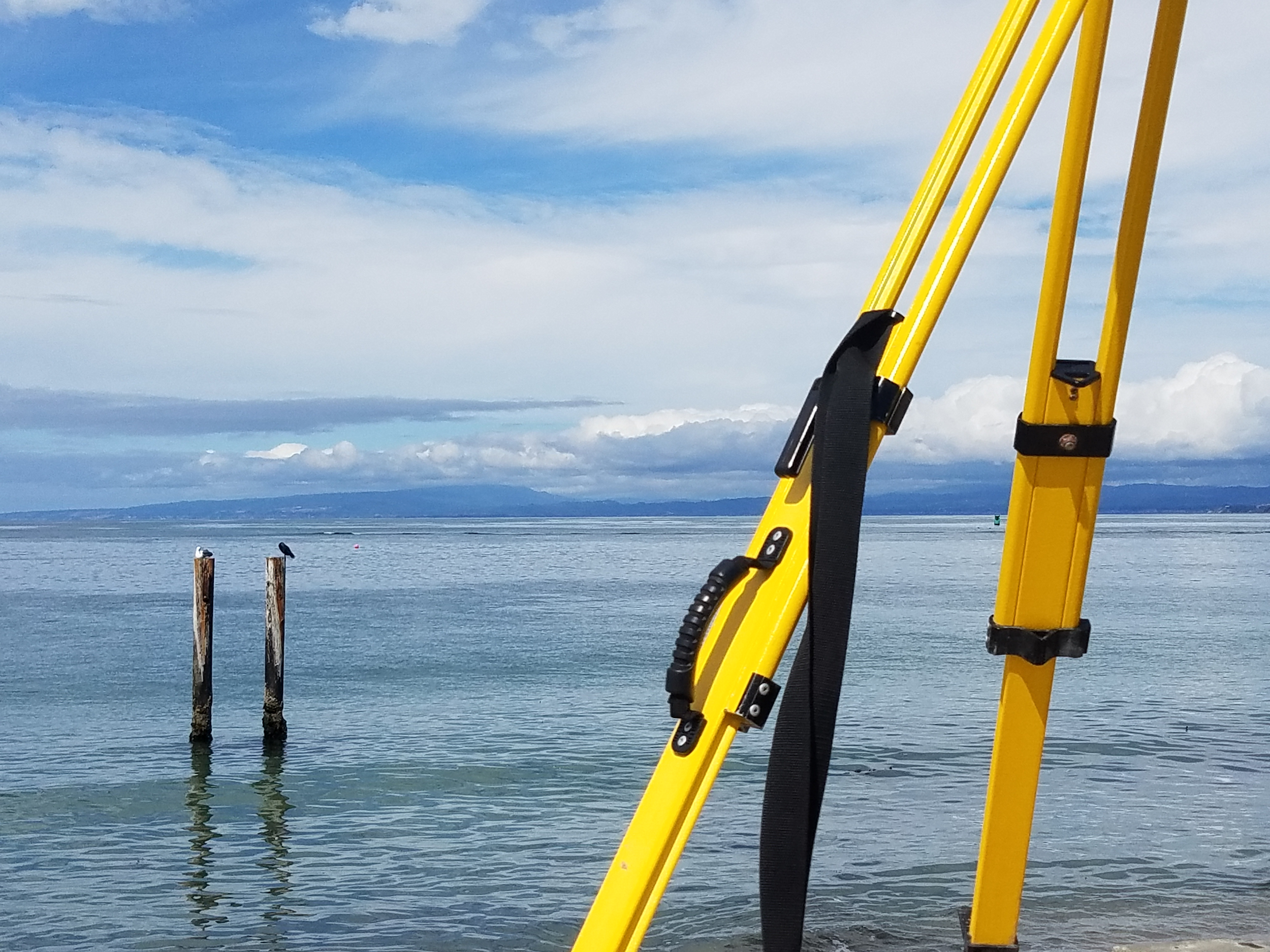
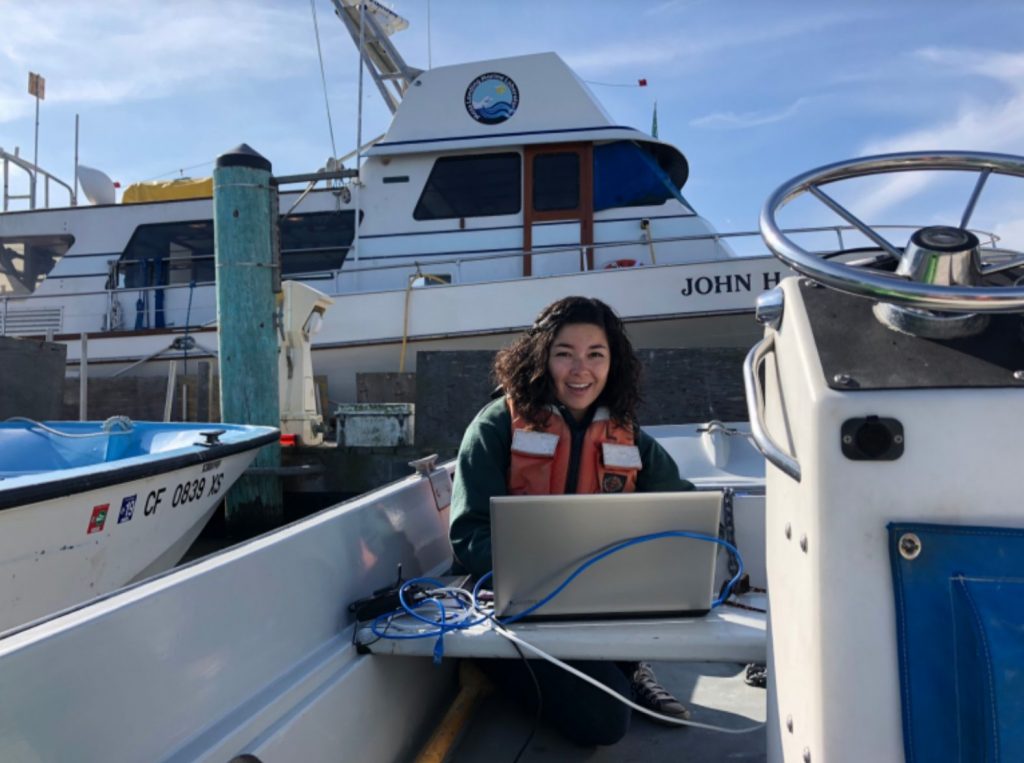
Along the way, the MLML “Shop Guys” built us a pole mount to attach the M3 to a MLML whaler, a boat that we can take out to the canyon and survey within an hour or two. Dr. Ivano Aiello brought the M3 to the lab and QPS supplied the software to be able to acquire and process data. Dr. Tom Connolly supplied a field laptop that is water resistant, has a bright enough screen to beat the sun, and has a fantastic battery life, and we brought student brains that figured the rest out. This meant lots of reading manuals, troubleshooting, and more troubleshooting. When we couldn’t troubleshoot alone anymore, Pat Iampietro from CSUMB helped us through a major sticking point with his expertise. The wonderful community and affiliates of Moss Landing Marine Labs were integral to our journey the past few months.
Though we’ve had many challenges throughout the semester, we’ve succeeded in conducting some promising preliminary surveys with the equipment we have available: the field laptop, a Trimble ProXH GPS, and our M3. We’ve collected preliminary data in the Moss Landing Harbor as well as the head of the Monterey Submarine Canyon. See a map of some preliminary depths below:
Map of preliminary data collected by M3 in Moss Landing Harbor and head of submarine canyon. Red colors are shallow and blue colors are deep.
Still, we are in need of a few additional sensors to make any data collected with our system truly scientifically sound, including something called a Motion Reference Unit (MRU) and a gyro compass. Seafloor mapping draws from the fact that sound travels about five times faster in water than in air. The M3 is a transducer --or speaker-- that emits sound toward the seafloor, listens for the return, and calculates the two-way travel time to infer the depth of the seafloor below the boat.
Therefore, you must supply tide information (tide info found from NOAA tide gauges online), speed of sound information (which we do not yet have a way of measuring), information of the boat due to waves, as well as precise position information. An MRU would provide very precise information regarding the motion of the boat due to the motion of the ocean. Without athese measurements, we can’t be sure if the depths we are gathering are accurate. We can’t be sure because the motion of the boat would affect the angle at which the sound from the M3 is emitted which would affect the angle of return and therefore depth measurements. A gyro compass would give us accurate measurements of heading, which is critical to determining the direction the boat is moving with very high precision. We hope to get these sensors soon so that we can continue investigating the cause(s) of submarine landslides in the Monterey Canyon.
Having struggled with instrument troubleshooting, system setups, and constantly untangling cables, we gained a vast appreciation for marine technicians. Throughout this journey, we noticed that we couldn’t really find information about the inevitable struggles of setting up a new scientific system for the first time and decided to keep track of our trials and tribulations by way of a National Geographic Open Explorer Expedition. Read more here!
The OpenROV Trident the team won in the S.E.E. (Science Exploration Education) Initiative competition from National Geographic being opened in the lab!
You can subscribe to our Open Explorer page to receive updates when we reach new milestones (or more likely encounter new challenges). The Open Explorer page was also a part of a National Geographic Competition to win an underwater drone (aka remotely operated vehicle (ROV)), which we found out that we won! We hope that the underwater drone will provide a method of validating our seafloor mapping data once we’ve gathered the rest of the equipment we need, as well as prove useful for the rest of the MLML community.
Finally, we’d like to thank MLML for their amazing support in following our Open Explorer Expedition. We grew from 2 to 76 followers in two days, and are overwhelmed with the amount of help from our small community.
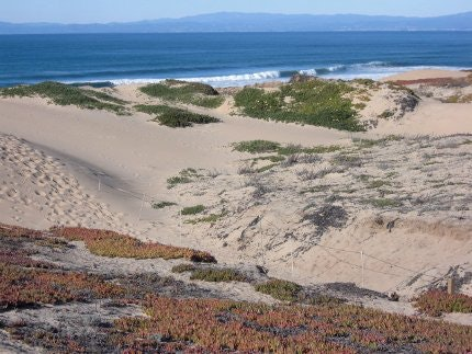
Dunes are essential to protecting our low-lying coastal communities and agriculture fields here in Monterey from storms, waves, and erosion. The beautiful slopes of these beach dunes are naturally controlled by the wind and the waves. The dunes that we see here are blanketed by green and red ice plant. Ice plant (Carpobrotus edulis) was introduced in the early 1900s to stabilize the naturally shifting dunes, but scientists now think that it may actually increase erosion.
It grows very quickly, forming a thick, heavy mat which can collapse the soil or sand underneath. The ice plant then drops to the new elevation, instead of anchoring the sand. In addition, ice plant is an invasive species that hampers ecosystem diversity and the growth of native plants. The latter have longer root systems that serve to stabilize the dunes. They don’t drop in elevation but allow dune sand to shift around them and build back up when less intense winds drift sand their way. It may be important to eradicate ice plant and introduce native plants for the preservation of not only our dunes but also our communities as climate change increases the frequency of storm events.
(Monterey Bay Regional Park District)
For a class project in the Habitat Mapping class taught at MLML in Fall 2018, we worked with the Central Coast Wetlands Group (CCWG), which is an affiliate research group at Moss Landing Marine Lab (MLML) focused on the study, preservation and restoration of Central Coast Wetlands in the Monterey Bay Area. They are currently working on a restoration project along the Salinas River State Beach, removing ice plant and planting native plants. The area being restored is from just south of the Protrero Road entrance down to the mouth of the Salinas River. Thanks to the CCWG and the MLML’s Geological Oceanography Lab, we acquired drone surveys from 2015 and 2016 and a plethora of additional information of the same area we surveyed for our project.
Questions for our study and how we planned to go about it
In our study, we focused on some basic questions: how much and where sand erosion is occurring on dunes around Moss Landing, and, how does dune morphology respond to restoration over time, specifically from October 2015 to December 2018?
Our experience: what we did for our fieldwork and post processing; hardships
To answer these questions, we surveyed 2 sections of beach in front of MLML. Our first survey took place on the beach in front of the aquaculture center adjacent to the head of the Monterey Submarine Canyon and continued south to the Protrero Beach entrance. This was our ‘practice run’ - gathering data for MLML, but not in connection to the CCWG restoration project. Our second survey was from the Protrero Beach entrance, continuing south for approximately 300m. This section is part of the CCWG project and where we are able to show possible changes in dune morphology with restoration over time.
Troubleshooting issues with spray paint (Amelia Labbe)
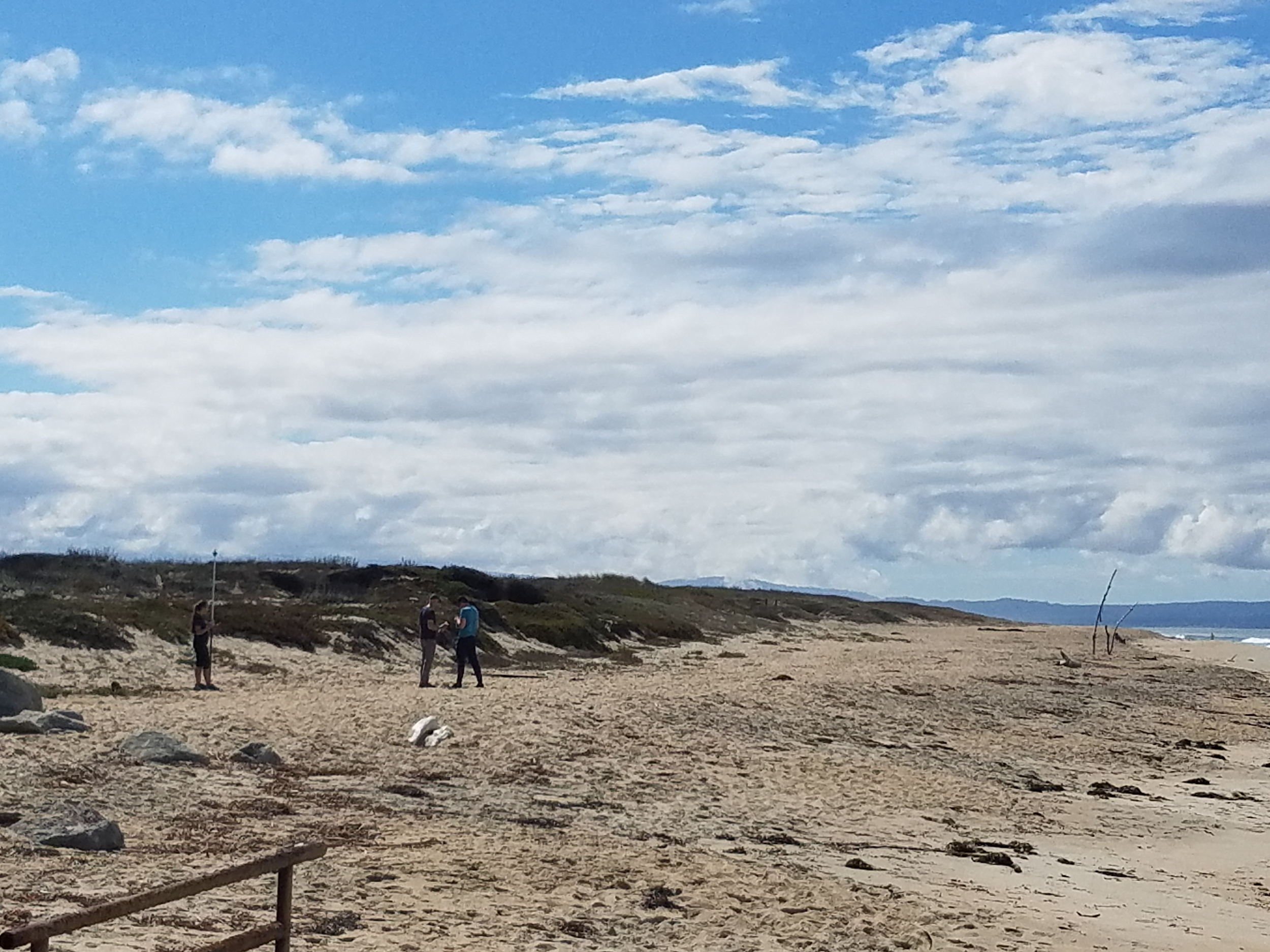
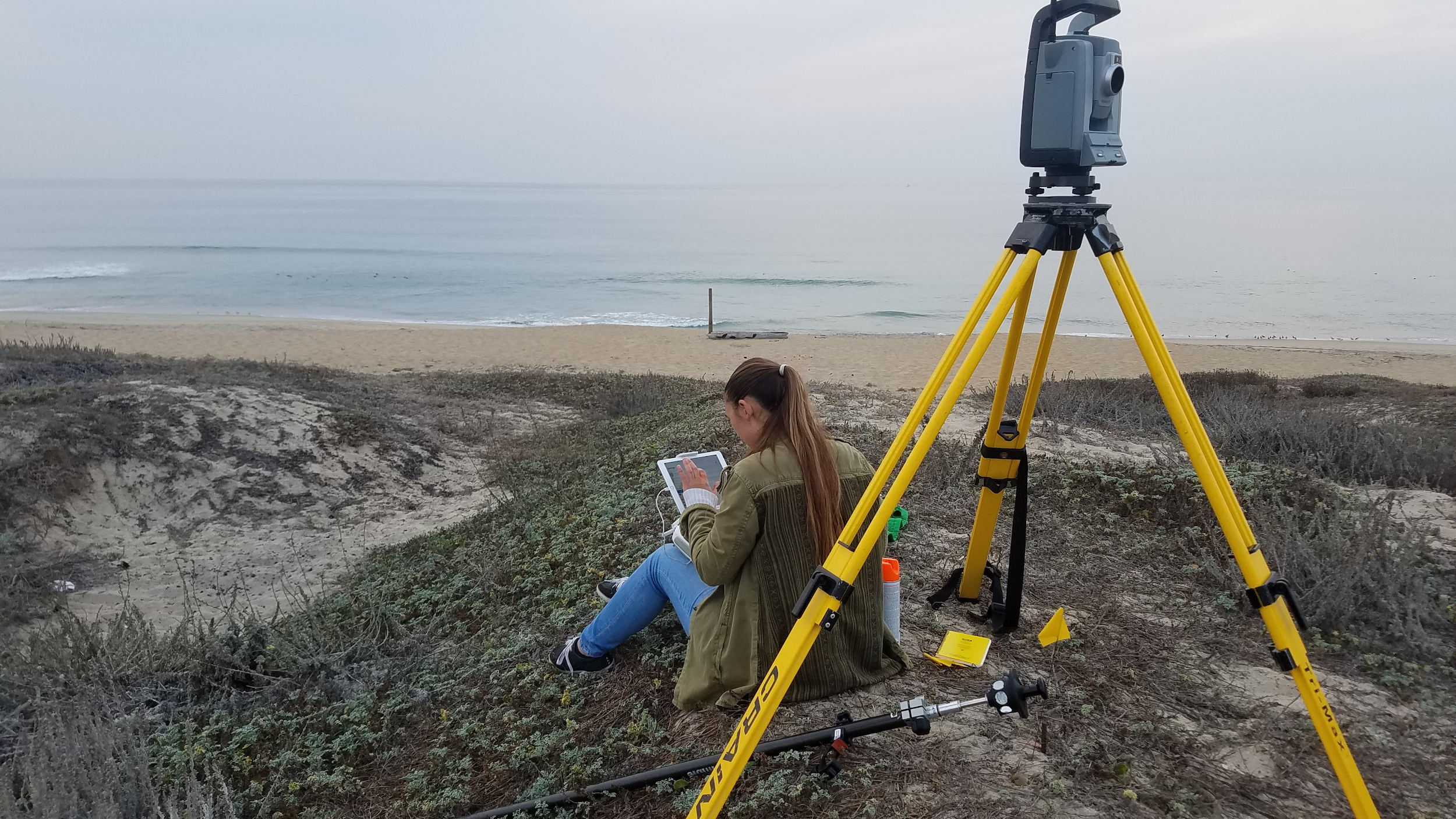
In order to survey an area, the protocol is to set up specific ground control points for geospatial accuracy. We did this by using a Terrestrial Laser Scanner (TLS), a GPS, and some spray paint. We spray painted marks on the beach where we plotted ground control points with the TLS, and then flew a drone to take pictures of the dunes and the marks on the beach.
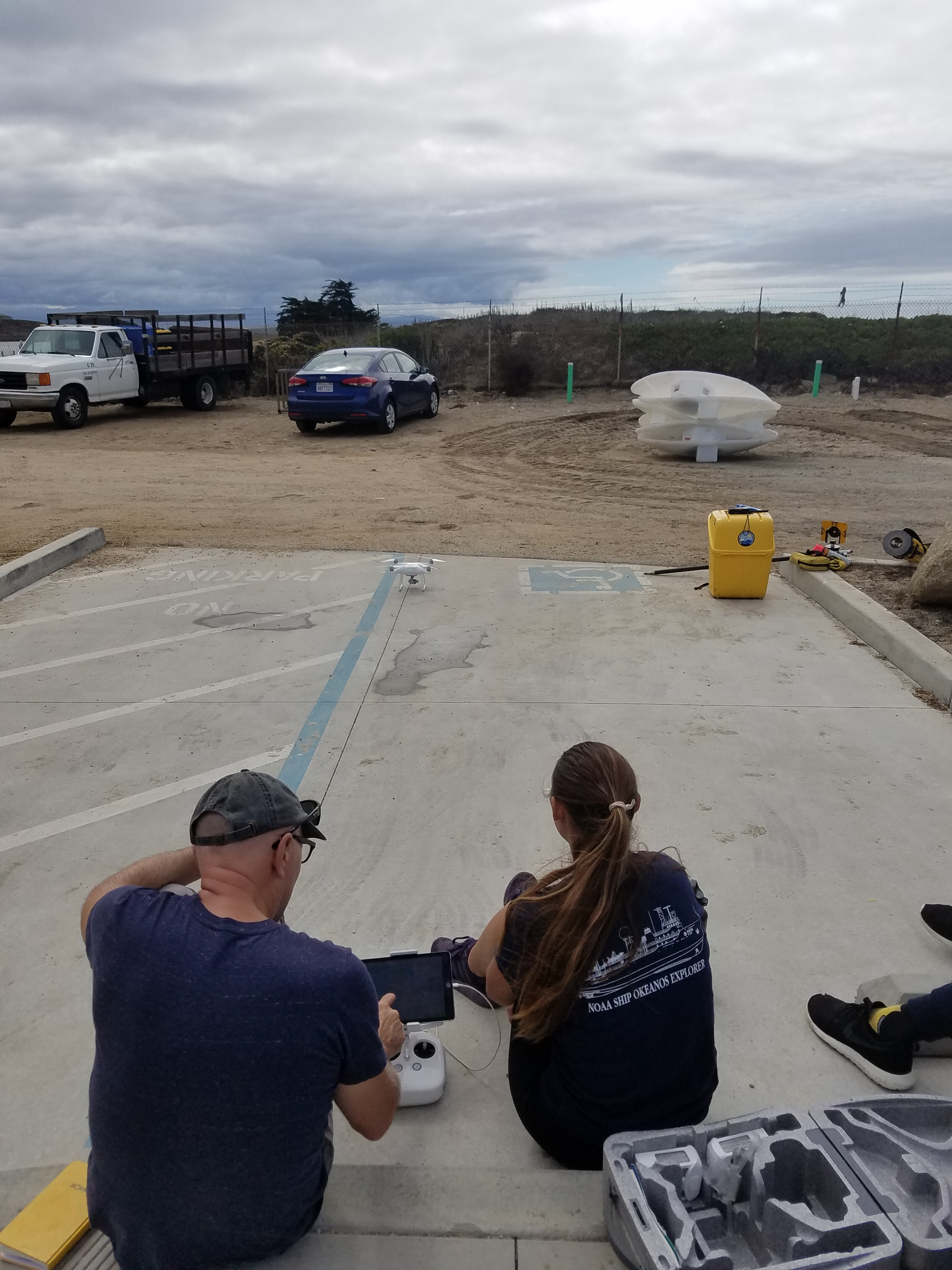
Learning how to fly the drone. (Amelia Labbe)
Back at the lab, we identified the ground control points from the drone photos using Pix4D software. Pix4D evaluates the quality of our survey data, and if the quality report looked good, we could move on to verifying our accuracy in comparison to the data from 2015. We did this by finding the same geographical points on each survey and confirmed that the didn’t differ by more than a few meters.
Unfortunately, we had some trouble with the pre-processing of our drone surveys of survey Area 2 (Area 2) in Pix4D. We found out (after attempting to survey the same area multiple times) that the camera optimization parameter was off. Thankfully, this was an easy fix, and we could still salvage the survey data from that location.
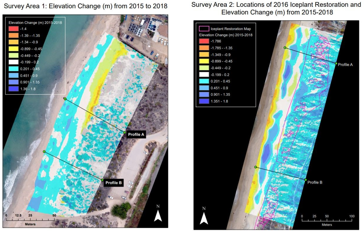
We made some beautiful figures of our raster calculations comparing elevation changes from 2015-2016, 2015-2018, and 2016-2018 for both survey areas. For clarity and elucidation, we narrowed it down to the elevation changes from 2015-2018 in both locations.
Getting ready to fly the drone in survey Area 2, south of Protrero Beach entrance (Amelia Labbe)
Using ArcMap, our 2018 drone surveys, and the CCWG 2015 drone surveys, we could analyze how much the dunes have changed due to weather events, erosion, ice plant removal, etc.
Since survey Area 1 (Area 1) has not had dune restoration in more than 20 years, it served as a control area and an opportunity for us to learn about dune changes and familiarize ourselves with the Pix4D and ArcGIS software. Figure 1 shows changes in elevation from 2015 to 2018 in Area 1. For this comparison, we used a raster calculation in ArcMap. It is important to remember that dunes shift naturally, so if even the face of the dune shifts forward or backward by a couple of centimeters, it can appear as a drastic change in elevation.
Figure 1 (left). Survey Area 1 serving as our control Figure 2 (right). Survey Area 2 serving as the experimental location
On the face of the dunes in survey Area 2 (Figure 2), we can see more accretion than erosion. The CCWG implemented dune restoration in the polygons outlined in pink. The restoration aimed to decrease the rate of dune erosion on the face of the dunes. In Area 1 (Figure 1), we can see elevation loss at the face of the dune. High wave energy is associated with natural erosion dune faces. Area 1 is located adjacent to the head of the Monterey Bay Canyon where it is exposed to higher wave energy than areas further south, explaining the erosion in this location. The back of the dunes in Area 1 experienced very little change in elevation, while in Area 2 (Figure 2), we see a fair amount of accretion. This may be due to the offset of the processed file having a possible bias towards accretion in this zone.
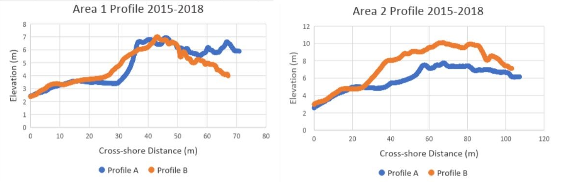
In Figures 1 and 2, we took cross sections of the elevation changes at locations ‘Profile A’ and ‘Profile B’. We then made profile graphs of these changes in Arcmap (Figures 3 and 4).
Figure 3 (left). Survey Area 1 profile of beach/dune elevation changes in locations A and B. Figure 4 (right). Survey Area 2 profile of beach/dune elevation changes in locations A and B.
These cross sections show how much height was gained (positive numbers) or lost (negative numbers) between 2015 and 2018. In figure 3, Profile A shows erosion at the face of the dune (~30m cross-shore distance), which is typical at high wave energy zones. In both of the profiles in figure 3, we do not see a wide range in elevation changes until they cross the face of the dune. In figure 4, just a few meters from the shoreline, these profiles show that there is a relative trend toward accretion. In the same figure, we can also see that the accretion is higher in profile B at the face of the dune (~30m cross-shore distance), where there was no dune restoration. It is important to note that the removal of ice plant is not scientifically proven to decrease erosion rates or increase accretion rates.
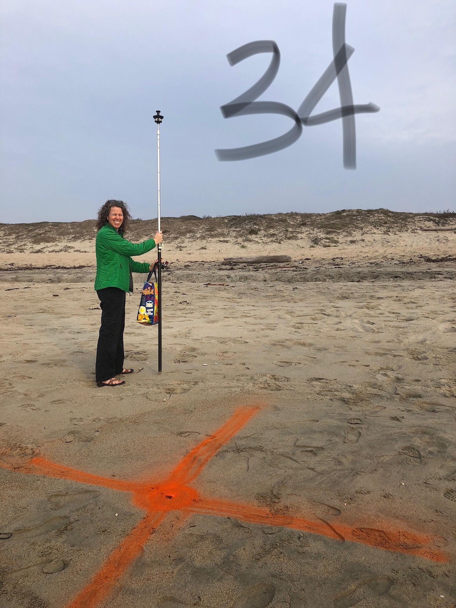
Survey Area 2: GCP 34 (Victoria Dickey)
What we can hope to accomplish in thefuture
In the future, we can continue to monitor dune morphology using drone surveys as the restoration progresses. We can see if the type of restoration has any influence on how much accretion appears on the dunes. We can also survey at a smaller scale to understand exactly how much erosion of the dunes is associated with ice plant.
Overall, this project helped us both learn about how to survey beaches and dunes using a TLS and a drone. We spent countless hours on ArcMap and Pix4D and have learned more about the programs than we thought we were capable of. We want to give a huge thank you to Ivano Aiello for helping us every step of the way and to the CCWG for giving us valuable information and continuing to preserve our land. Also, a huge thanks to Miya Pavlock-McAuliffe for helping us with ArcMap and thanks to David Carpenter for making some beautiful crosses on the beach.

 By Bri Sotkovsky,
  By Jessie Doyle, Gilbert Mak, and Katie Szelong
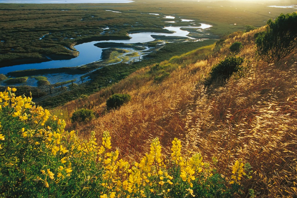
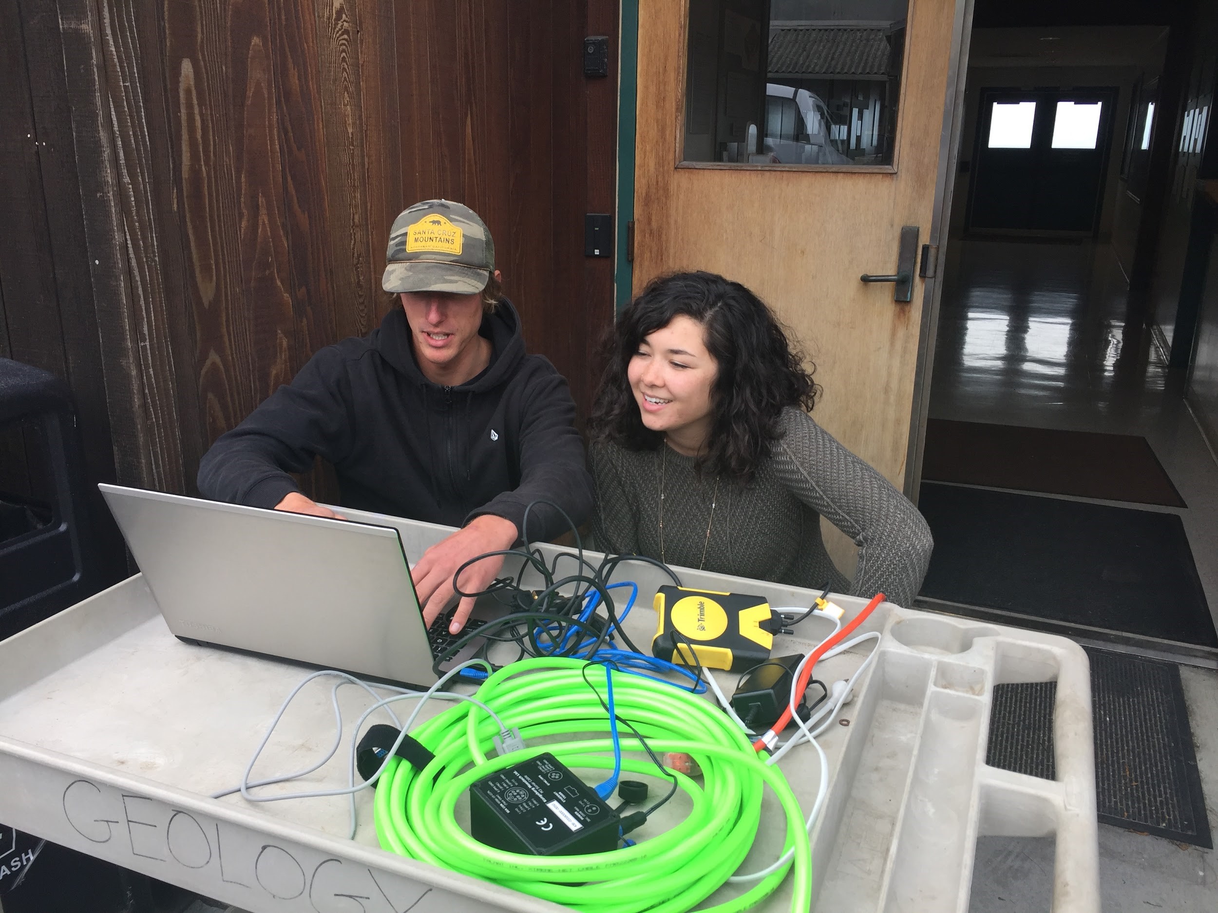
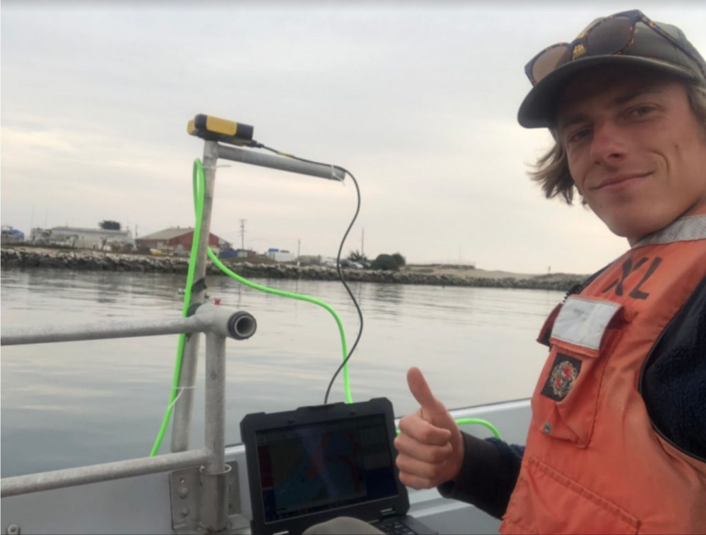 Along the way, the MLML “Shop Guys” built us a pole mount to attach the M3 to a MLML whaler, a boat that we can take out to the canyon and survey within an hour or two. Dr. Ivano Aiello brought the M3 to the lab and QPS supplied the software to be able to acquire and process data. Dr. Tom Connolly supplied a field laptop that is water resistant, has a bright enough screen to beat the sun, and has a fantastic battery life, and we brought student brains that figured the rest out. This meant lots of reading manuals, troubleshooting, and more troubleshooting. When we couldn’t troubleshoot alone anymore, Pat Iampietro from CSUMB helped us through a major sticking point with his expertise. The wonderful community and affiliates of Moss Landing Marine Labs were integral to our journey the past few months.
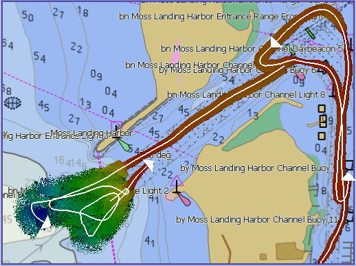
 Having struggled with instrument troubleshooting, system setups, and constantly untangling cables, we gained a vast appreciation for marine technicians. Throughout this journey, we noticed that we couldn’t really find information about the inevitable struggles of setting up a new scientific system for the first time and decided to keep track of our trials and tribulations by way of a National Geographic Open Explorer Expedition.